Aug. 5: 'Habagat' inducing rains, thunderstorms across Philippines
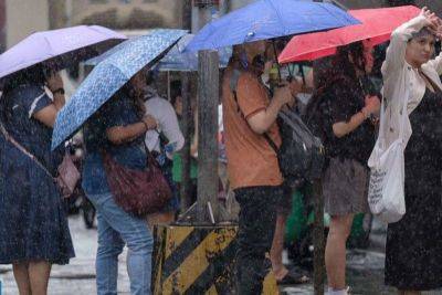
MANILA, Philippines — The southwest monsoon on Monday, August 5 is likely to trigger rains and thunderstorms in several parts of the country while a low-pressure area is within the Philippine area of responsibility.
In its 4 a.m. advisory, state weather bureau PAGASA said cloudy skies, scattered rains and thunderstorms are expected over Zambales, Bataan, Occidental Mindoro, Palawan, Western Visayas, Negros Island Regionand Central Visayas due to the monsoon, locally known as "habagat."
It is also causing partly cloudy to cloudy skies with isolated rainshowers or thunderstorms over Mindanao, Cavite, Batangas and the rest of MIMAROPA and Visayas.
Metro Manila and the rest of Luzon will have partly cloudy to cloudy skies with isolated rainshowers or thunderstorms due to localized thunderstorms.
These conditions, PAGASA warns, may also cause flash floods or landslides during severe thunderstorms.
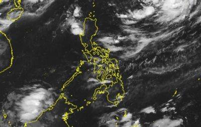
Two low-pressure areas. A low-pressure area was spotted 1,155 km east northeast of extreme Northern Luzon as of 3:00 a.m. while another LPA is being monitored right outside the vicinity.
Winds. Winds will be light to moderate, coming from the northwest to southwest over Luzon and from the southwest over Visayas and Mindanao. Coastal waters will be slight to moderate, with wave heights ranging from 0.6 to 2.1 meters.
Related News