Signal No. 1 in effect in Visayas, Mindanao due to Tropical Depression Kabayan
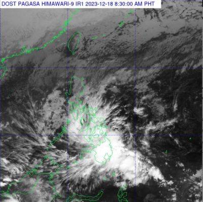
MANILA, Philippines — State weather bureau PAGASA on Sunday morning placed several areas in Visayas and Mindanao under Signal Number 1 due to Tropical Depression Kabayan.
Kabayan was last seen 460 kilometers east of Davao City, with peak winds of 55 km per hour near the center and gusts of up to 70 kph. It was heading 15 kph.
PAGASA raised Signal No. 1 over the following areas:
Minimal to minor impacts from strong winds are possible within any of the areas under Winds Signal No. 1.
PAGASA warned of heavy rainfall in parts of Mindanao and Visayas due to Kabayan.
Sunday
Monday
According to the weather agency, forecast rainfall is generally higher in elevated or mountainous areas. It warned that flooding and landslides may occur, especially in areas that are susceptible to these hazards or have experienced considerable amounts of rainfall for the past several days.
PAGASA said that the surge of northeast monsoon will bring gusty conditions for the next two days over the following areas not under any wind signal, especially in coastal and upland areas:
"Hazards such as severe wind and heavy rainfall may be experienced in areas that are not close to the track forecast," the weather bureau said.
Kabayan is expected to follow a generally west northward path across the archipelago over the next two days and is likely to maintain its strength until its initial landfall over Mindanao. PAGASA is not ruling out the possibility of Kabayan reaching tropical storm category before landfall.
The cyclone is likely to make landfall along the coast of Surigao del Sur or Davao Oriental Sunday evening or early Monday morning, cross the rugged terrain of Mindanao, and emerge over Bohol Sea or Sulu Sea Monday noon or afternoon.
"Due to frictional effects associated with landfall, KABAYAN is forecast to weaken over land and the possibility of being downgraded into a low pressure area while over land or after emerging over the sea is not ruled out (although in such a case, re-development may still occur over the Sulu Sea)," PAGASA said.
Kabayan will move across the Sulu Sea south of Cuyo Islands for the remainder of Monday and into early Tuesday. It is forecast to make another