Signal No. 1 up in parts of Metro Manila, other Luzon areas as 'Gener' weakens
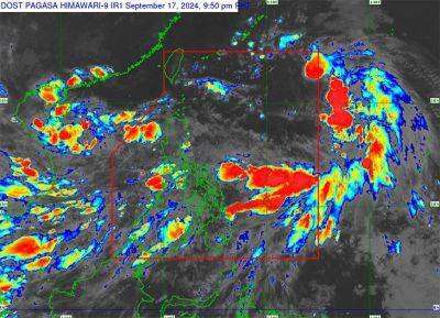
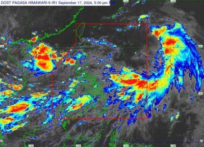
MANILA, Philippines — Several parts of Metro Manila and other Luzon areas remain under Tropical Cyclone Wind Signal No. 1 as Tropical Depression Gener slightly weakened while moving over the Cordillera region.
As of 8:00 a.m. on Tuesday, September 17, PAGASA reported that Gener was spotted in the vicinity of Ambaguio, Nueva Vizcaya.
Moving at a speed of 15 kilometers per hour, Gener was carrying peak winds of 55 kph near its center, with gusts reaching up to 70 kph.
It was heading southwestward at 15 kph.
PAGASA raised Signal No. 1 over the following areas:
Residents of areas under Signal No. 1 could experience minimal to minor impacts from strong winds, ranging from 39 to 61 kph.
PAGASA warned of possible floods and landslides due to heavy rain. Strong winds, especially in coastal and upland areas, will continue in places under Signal No. 1, where minor wind damage is likely.
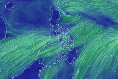
The southwest monsoon or habagat, enhanced by Gener and Tropical Storm Pulasan, is expected to to bring gusty conditions over the following regions:
A gale warning is in effect for coastal waters in northern Luzon, southern Luzon, Visayas and Mindanao.
Rough seas, ranging from 1.5 to 3.0 meters high, are expected along the eastern seaboard of Bicol Region, Visayas (outside gale warning areas) and the eastern seaboards of Caraga and Davao Regions.
Moderate seas of up to 2.5 meters are forecasted for other coastal areas not under gale warning.
PAGASA advised mariners, especially those with small or poorly equipped vessels, to avoid going out to sea.
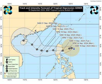
"Gener" is expected to reach the coastal waters of Ilocos Sur or La Union later on Tuesday and will move westward over the West Philippine Sea until Thursday, September 19.
It may intensify into a tropical storm after exiting the Philippine Area of Responsibility (PAR) on Tuesday night or early Wednesday. tomorrow.
PAGASA said that Gener might weaken to a low pressure area (LPA) while crossing northern Luzon's rugged terrain. However, it could become a tropical storm by Wednesday morning if it strengthens over the West Philippine Sea.