Storm Carina intensifies, enhances habagat
MANILA, Philippines — The Philippine Atmospheric, Geophysical and Astronomical Services Administration (PAGASA) yesterday said that Tropical Storm Carina is expected to exit the Philippine area of responsibility (PAR) by midweek, adding that it will enhance the southwest monsoon bringing rains to many areas in the country.
In a briefing, PAGASA weather specialist Veronica Torres said that Carina (international name Gaemi) may reach severe tropical storm category by Sunday night, and typhoon category by Monday evening.
Under PAGASA’s tropical cyclone wind signal system, a typhoon is declared if it has sustained winds of 118 to 184 kilometers an hour; severe tropical storm, 89 to 117 km/h; tropical storm, 62 to 88 km/h, and tropical depression less than 61 km/h.
“Carina may leave the Philippine area of responsibility by Wednesday night or Thursday early morning, as we do not discount the possibility of its rapid intensification,” Torres added.
She said Carina is forecast to move generally north northwestward to northward.
Torres said that Carina slightly intensified over the Philippine Sea, as its center was located at 350 kilometers east of Casiguran, Aurora with maximum sustained winds of 85 km/h near the center, gustiness of up to 115 km/h, as it is moves westward at 20 km/h.
“After 24 hours, we expect Carina to be located 345 kilometers east of Tuguegarao City, Cagayan; and then after 48 hours, 295 kilometers east southeast of Basco, Batanes; and then by July 24, 345 kilometers east northeast of Itbayat, Batanes; and by July 25, it is already outside PAR at 565 kilometers north of Itbayat, Batanes,” Torres said.
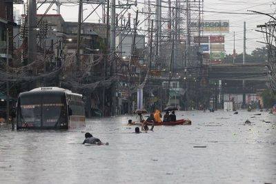
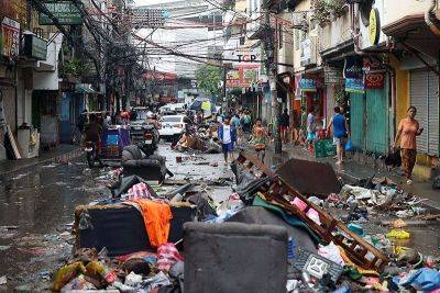
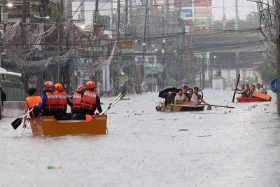
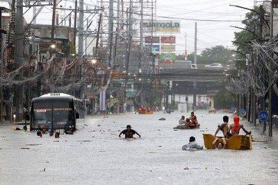
She added that the enhanced southwest monsoon will bring strong rains in the western section of Luzon.
“Currently, Carina is affecting east and northern Luzon. No wind signal has been hoisted at this time, but we don’t rule out the possibility of raising signal number 1 in extreme Northern Luzon and the northeastern portion of mainland Cagayan,” Torres said.
According to Torres, the tropical depression outside PAR, or formerly “Butchoy” will also enhance the southwest monsoon, also known as habagat.
“The southwest monsoon being enhanced by Carina and
Related News