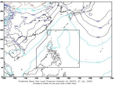
Tropical Storm Carina continues to intensify
MANILA, Philippines — SEVERE Tropical Storm Carina continues to intensify as it moves northwestward over the Philippine Sea, the Philippine Atmospheric, Geophysical and Astronomical Services Administration (Pagasa) said Monday.
Signal No. 1 remains up over the eastern portion of mainland Cagayan (Santa Ana, Gattaran, Baggao, Peñablanca, Lal-Lo and Gonzaga) including the eastern portion of Babuyan Islands (Camiguin Island and Babuyan Island) and the northeastern portion of Isabela (Divilacan, Palanan and Maconacon).
It said that the center of Carina was last spotted some 340 kilometers east-northeast of Casiguran, Aurora.
Moving at the speed of 15 kilometers per hour (kph), the severe tropical storm had maximum sustained winds of 110 kph near the center and gustiness of up to 135 kph, Pagasa said in its 11 a.m. advisory.
Forecast to move generally northward until Tuesday, Carina would gradually accelerate before it turns northwestward for the remainder of the forecast period.
«On the track forecast, Carina will remain far from the country's landmass and exit the Philippine Area of Responsibility on Wednesday evening or Thursday early morning,» Pagasa said.
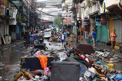
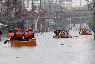
Meanwhile, the southwest monsoon locally known as habagat is being enhanced by Carina bringing moderate to intense rainfall especially in the western portion of Luzon including Metro Manila.