'Enteng' intensifies into severe tropical storm
MANILA, Philippines — Tropical cyclone Enteng (international name: Yagi) has further intensified into a severe tropical storm, state weather bureau PAGASA said.
In PAGASA’s 5 p.m. advisory on September 3, Enteng was located 165 kilometers west-northwest of Laoag City, Ilocos Norte, with maximum sustained winds of 95 kilometers per hour (kph) and gusts of up to 115 kph, moving west-northwestward at 10 kph.
Strong to storm-force winds extend outwards up to 330 kilometers from the center, according to PAGASA.
Tropical Cyclone Wind Signal No. 1 is raised over the following areas:
Winds in these areas are forecasted to range between 39 and 61 kph, with minimal to minor impacts expected.
Expected rainfall on Tuesday to Wednesday afternoon is 50-100 mm in Ilocos Region and Abra.
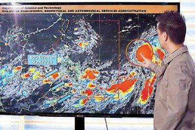
The southwest monsoon or habagat will also bring strong to gale-force gusts over the following areas:
Tuesday, September 3
Wednesday, September 4
Thursday, September 5
According to PAGASA, Tropical Storm Enteng is forecasted to exit the Philippine area of responsibility (PAR) on Wednesday morning, September 4.
After leaving the PAR, Enteng will continue moving westward until Friday morning, before shifting to a west-northwestward direction for the remainder of the forecast period.
The storm is expected to make landfall in southern mainland China over the weekend.
Enteng is anticipated to intensify throughout its course and may reach typhoon status by Thursday, September 5.
The storm is likely to reach its peak intensity by late Friday or early Saturday, just before making landfall in China, according to the state weather bureau.


