'Leon' advances west over Philippine Sea, Signal No. 1 possible by Sunday night
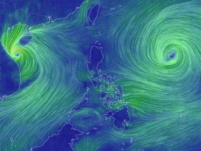
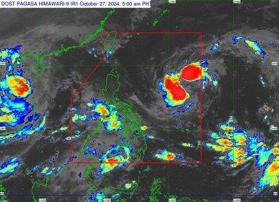
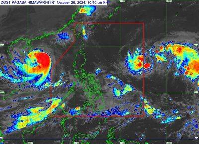
MANILA, Philippines — Tropical Storm Leon (international name: Kong-Rey) is moving steadily west over the Philippine Sea and is expected to bring rains and gusty winds to parts of Luzon.
State weather bureau PAGASA said Signal No. 1 may be raised over portions of Luzon, particularly in Cagayan Valley and northeastern Bicol, as early as Sunday night.
In its 11:00 a.m. weather bulletin, Leon was spotted 1,075 kilometers east of Central Luzon.
Carrying peak winds of 65 kilometers per hour near near its center and gustiness reaching up to 80 kph, Leon is moving westward at a pace of 30 kph.
Leon’s outer rainbands could brush Extreme Northern Luzon as it heads north-northwest.
Enhanced southwesterly winds, initially triggered by Tropical Storm Trami (formerly Kristine), are expected to impact Visayas, Mindanao and parts of Southern Luzon.
No tropical cyclone wind signal are in effect. Depending on Leon’s movement, Signal No. 2 may be the highest level issued.
Leon is expected to bring gusty winds, particularly in coastal and mountainous areas:
Rough sea conditions are expected across several coastal areas in the next 24 hours.
PAGASA warned mariners of hazardous sea conditions and risky travel for small vessels, including motorbancas in the following areas:
Leon is forecast to continue moving west on Sunday before shifting northwestward by Monday through Tuesday.
By mid-week, it may veer north-northwestward and could either pass very close or make landfall over the southwestern Ryukyu Islands in Japan.
The tropical storm is expected to strengthen, potentially reaching severe tropical storm status by Monday and typhoon classification by Tuesday.
Rapid intensification remains a possibility as it nears the northern Philippine Sea.