Metro Manila, others still under Signal No. 2 as 'Kristine' gains speed over Northern Luzon waters
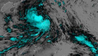
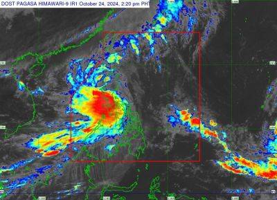
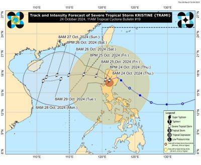
MANILA, Philippines — Metro Manila and other areas in Luzon remain under Signal No. 2 as Severe Tropical Storm Kristine (international name: Trami) maintains its strength while accelerating west-northwestward over the sea west of Northern Luzon.
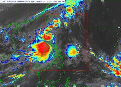
As of 4 a.m. on Friday, October 25, PAGASA reported that Kristine was spotted 125 kilometers west-northwest of Bacnotan, La Union.
Kristine is carrying maximum sustained winds of 95 kilometers per hour, with gusts reaching up to 115 kph. Its central pressure stands at 985 hPa.
It is now moving west northwestward at 25 kph.
The following areas are under tropical cyclone wind signals:
Residents of areas under Signal No. 2 could experience minor to moderate impacts from strong winds, with winds between 62 kph and 88 kph expected within at least 24 hours.
Luzon
Visayas
Strong winds ranging from 39 to 61 kph may be expected in at least 36 hours or intermittent rains may be expected within 36 hours.
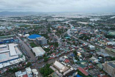
PAGASA said that Kristine is expected to bring heavy rains to parts of Northern and Central Luzon on Friday.
Moderate to heavy rainfall (50-100 mm) will affect several areas, including Pangasinan, La Union, Benguet, Tarlac, Pampanga, Zambales and Bataan. While torrential rains are not expected, PAGASA warned of possible flooding and landslides.
The following areas will be under threat of strong to gale-force gusts:
Storm surge, sea conditions
The state weather agency warned of a minimal to moderate risk of storm surge, with heights expected to reach 1.0 to 2.0 meters above normal tide levels in the next 48 hours. Coastal areas of Ilocos Sur, La Union, Pangasinan and Zambales are especially at risk.
PAGASA also advised mariners of hazardous sea conditions and risky travel for small vessels, including motorbancas in the following areas:
Kristine is expected to move further west-northwest and exit the Philippine area of responsibility (PAR) later today.
However, PAGASA said that there is a possibility that Kristine could re-enter PAR next week, depending on the development of another weather system.
While Kristine is expected to remain a severe tropical storm, there is a slight chance it could intensify into a typhoon as it
Related News