Six areas in Mindanao under Signal No. 2 ahead of Kabayan's landfall
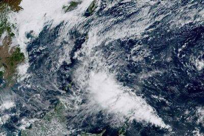
MANILA, Philippines — State weather bureau PAGASA placed several areas in Mindanao under Wind Signal No. 2 Monday morning as Tropical Storm Kabayan (international name: Jelawat) approached the Philippine landmass.
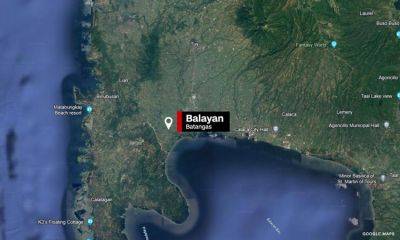
Kabayan, the country's 11th cyclone this year, was last spotted over the coastal waters of Manay in Davao Oriental. Moving west at 20 kilometers per hour, it is expected to make landfall in the province this morning.
The tropical storm is packing peak winds of 65 kph near the center and gusts of up to 80 kph.
PAGASA hoisted wind signals in the following areas:
Residents of areas under Signal No. 2 may experience minor to moderate impacts from gale force winds.
Minimal to minor impacts from strong winds are possible within any of these areas.
According to PAGASA, Surigao del Sur, Surigao del Norte, Dinagat Islands, Agusan del Sur, Davao del Norte, Davao de Oro and Davao Oriental are expected to receive an accumulated rainfall of 100 to 200 millimeters today.
Meanwhile, Central Visayas, Biliran, Leyte, Southern Leyte, Zamboanga del Norte, Northern Mindanao, Davao City, Cotabato, Lanao del Sur, the southern portions of Samar and Eastern Samar, and the rest of Caraga, Davao Oriental, Davao de Oro, and Davao del Norte will have an accumulated rainfall ranging between 50 and 100 millimeters.
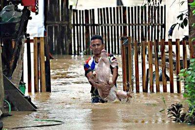
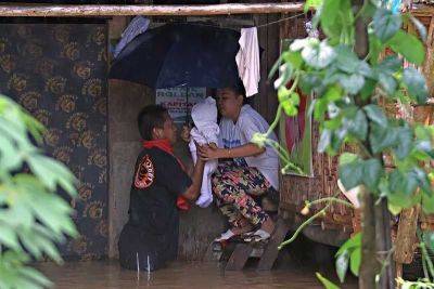
The weather bureau warned that rainfall is expected to be higher in mountainous areas. This may result in flooding and landslides, particularly in areas highly susceptible to these hazards and those that have experienced significant rainfall in recent days.
The shear line, a weather system formed when cold and warm winds converge, may also bring heavy rain to the eastern portion of southern Luzon.
PAGASA said that once Kabayan makes landfall in Davao Oriental, it is forecast to cross Mindanao's rugged terrain and emerge over Sulu Sea this afternoon or evening.
Kabayan is expected to be downgraded into a tropical depression after landfall.
It is also not ruling out the possibility of the cyclone being further downgraded into a low pressure area while over land or after emerging over the sea. In such a case, however, redevelopment into a cyclone may still occur
Related News