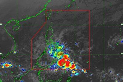
LPA in Mindanao
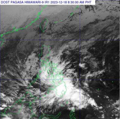
A CLOUD cluster outside the Philippine area of responsibility (PAR) developed into a low pressure area yesterday, the Philippine Atmospheric, Geophysical and Astronomical Services Administration (PAGASA) said.
PAGASA weather specialist Patrick del Mundo, in a public weather forecast, said the LPA, which was some 1,865 km east of southeastern Mindanao, has a small chance of intensifying into a tropical depression in the next two days.
“It’s possible it will enter our Philippine area of responsibility on Saturday and by Sunday, it will be near the eastern portion of Mindanao,” said Del Mundo.
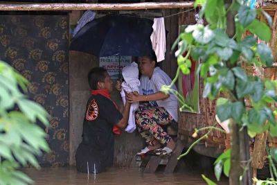
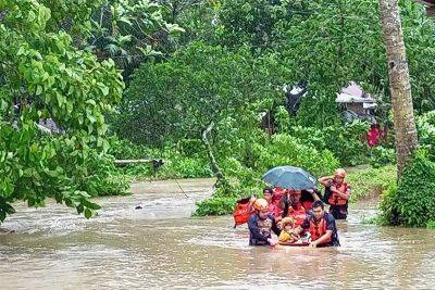
He urged residents of Mindanao and the Visayas to prepare for rains that are expected to be brought by the LPA.
“Our countrymen should take extra care and prepare for the low pressure area because this may bring rains in the eastern portion of Visayas and Mindanao,” he said.
PAGASA has said one or two tropical cyclones may enter or develop inside PAR this December.
The country has so far experienced 10 tropical cyclones this year. The last was typhoon “Jenny” in late September. The annual average of tropical cyclones in the country is 20 with July through October as the peak of the typhoon season.
PAGASA also said the fewer cyclones this year can be attributed partly to El Niño, a phenomenon that increases the likelihood of below-normal rainfall conditions that may lead to dry spells and droughts.
Related News