LPA likely to enter PH Friday – Pagasa
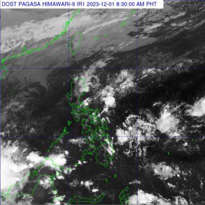
MANILA, Philippines: THE state-run weather agency said the low-pressure area (LPA) it has been monitoring over the past week will likely enter the Philippine Area of Responsibility (PAR) on Friday. Last spotted some 990 kilometers east of northeastern Mindanao, the LPA once inside PAR has a chance to develop into a tropical depression and will be named «Kabayan,» the Philippine Atmospheric Geophysical and Astronomical Services Administration (Pagasa) said in its 5 a.m. advisory.
PHOTO FROM DOST PAGASAWeather specialist Aldczar Aurelio said Kabayan, the 11th storm to hit the county this year and the first this month, is forecast to unlikely affect the entire archipelago. «This weather disturbance will likely enter PAR anytime today (Friday)» the Pagasa forecaster said. In the meantime, he said the shear line — where the hot and cold air converge — is affecting the eastern section of Visayas while the northeast monsoon locally known as «amihan» is affecting Luzon. The state weather bureau said the rest of the country will have partly cloudy to cloudy skies with isolated rain showers or thunderstorms due to shear line and localized thunderstorms within 24 hours.